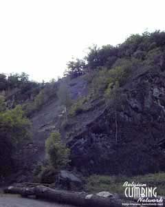
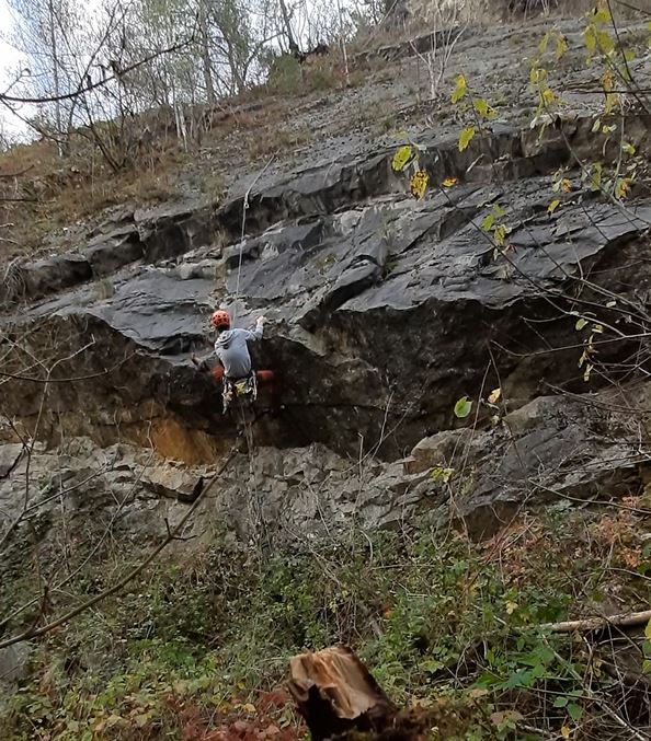
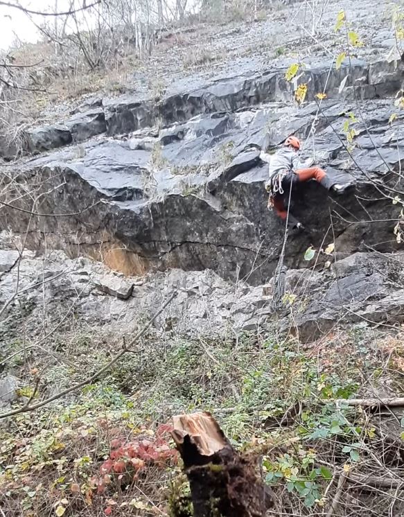
Dalle de Beaufort
- Location: Ben-Ahin (Huy)
- River: Ruisseau de Solières
- Rock type: quarry limestone
- routes:
- Equipement:
Important!
Most recent repetitions
- 25-11-20 - L'Y Renversé (4) - Sebastiaan
- 25-11-20 - Les Fourmis Noires (4) - Sebastiaan
- 25-11-20 - Bikers (4) - Sebastiaan
- 25-11-20 - La Rouille - départ dir… (6c) - Sebastiaan
- 25-11-20 - La Rouille (4) - Sebastiaan
Topos, publications, sources
Other climbing possibilities in the area
-
Porche de Roiseux
Marchin -
Rochers de Huccorgne
Huccorgne -
Rochers du Bois de Fau
Andenne -
Carrière de Sirou
Seilles
Photos

All routes
Discover every route available on this crag by clicking on the link below.
Sectors
Details
10 routes/pitches/variations
found in the Belclimb database
Sport climbing routes
Boulders
Aid climbing routes
Coordinates
NGI topographical map: 48/1-2Lambert coordinates: X 208.600 Y 134.750
UTM (ED50): 31U 655696E 5599024N
WGS84: 5.19507°E 50.52058°N